

OUR AI SOLUTION
Make smarter business decisions with Geospatial Data Science
Geospatial Data Science
AI Service
Bedrock empowers organizations to navigate complex geographies through geospatial data science. Our tools enable strategic investment, market expansion, and opportunity discovery. By integrating data analysis with geographic insights, your organizations can uncover critical trends, make impactful decisions, and gain a competitive edge.
3D Building
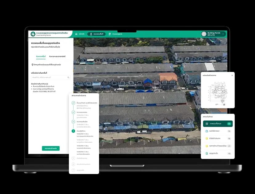
Accurate insights, endless possibilities: 3D building technology.
Leveraging advanced 3D building modeling techniques, Bedrock has harnessed the power of aerial drone imagery to provide unparalleled insights into spatial data. By generating highly accurate and visually immersive representations of urban environments, Bedrock enables users to effortlessly monitor structural changes, optimize resource allocation, and facilitate informed decision-making in fields such as urban planning, disaster response, and aviation.
3D building enhances flood analysis and building change monitoring by enabling realistic simulations and detecting structural changes.
Changes Of Urban Green Area
Bedrock's spatial data: A vital tool for green area management.
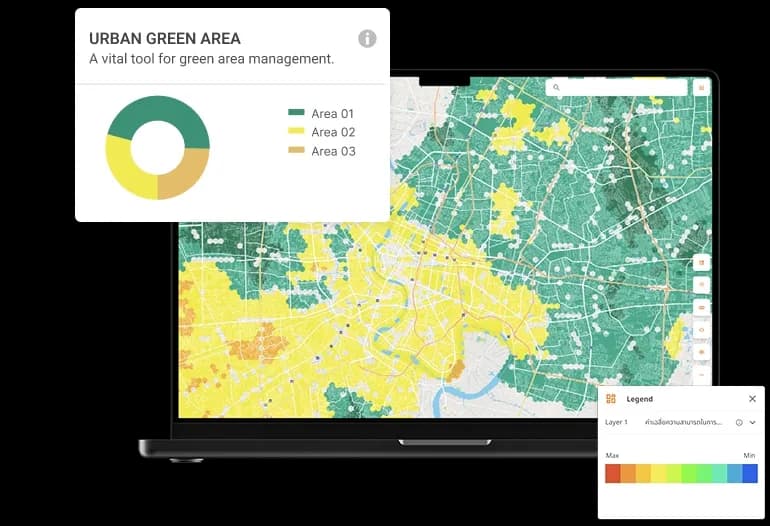
Monitor green area changes
Our platform leverages advanced remote sensing and geospatial data science to monitor and enhance green spaces. This innovative approach empowers smart cities with solutions that improve mental well-being, air quality, and urban planning. We contribute to global sustainability goals by fostering greener and more resilient environments.

Bedrock's platform for tracking and analyzing changes in green areas transforms how we manage our environment, delivering impactful results
Satellite and drone imaging analysis
Leverage the latest satellite and drone technology to gather precise data. This advanced imaging provides a solid foundation for informed decision-making, ensuring every choice is based on reliable insights.
GIS and Remote Sensing Techniques
Bedrock's platform facilitates in-depth exploration of the environment. This approach enhances our comprehension of intricate ecological relationships, enabling more strategic decision-making.
Resource-efficient surveying
Eliminate the need for time- consuming and resource- intensive on-site surveys. By reducing reliance on physical exploration, it accelerates the delivery of high-quality results.
Large area analysis capability
Bedrock's platform empowers users to efficiently analyze vast land areas, ensuring seamless environmental management regardless of project scale.
Dashboard visualization
Complex data is transformed into intuitive visualizations through Bedrock's user-friendly dashboard. This empowers users to make informed and strategic decisions to improve green areas.
In essence, spatial data from Bedrock is more than just a management tool. It's a driving force for positive change, helping create a healthier and greener future for all.

Please share your information and Bedrock will contact you soon.
Find out how we can help your business